Dublin-Worthington Rotary Club Playground Map Project: Step 3

Basic details
Dublin-Worthington Rotary Club Playground Map Project: Step 3 is an image, with genre photograph.
Its dimensions are 4 in. x 6 in..
It was created sometime in 1997.
Worthington Libraries is the contributor.
You can find the original at Worthington Libraries.
Background
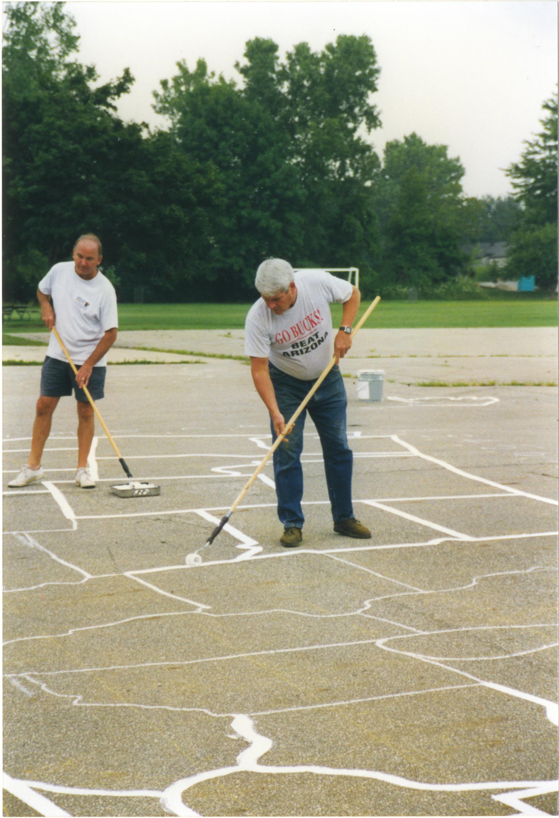
The idea for painting large-scale U.S. maps on the playgrounds of local schools came about when a member of the Dublin-Worthington Rotary Club read about a similar project in another state. The club felt that the maps would be both educational and entertaining for students. The club worked with the Center for Mapping at The Ohio State University, which provided a grid-based master template. After creating a 30- by 50-foot chalk grid on each playground's surface, Rotarians used the master template as a guide to draw chalk outlines of each state. Club members then painted over the chalk outlines to complete the maps. This photograph shows Rotarians painting the state outlines.
Subjects
It features the organization Dublin Worthington Rotary Club.
It covers the city Worthington.
Record details
This file was reformatted digital in the format video/jpeg.
The Worthington Memory identification code is DWR0018.
This metadata record was human prepared by Worthington Libraries on . It was last updated .


